Here are public weather warnings and alerts from Environment Canada for Ontario and Quebec.
Ontario, Canada
According to Hydro One, presently (at the time of this blog posting) more than 50,000 customers in Ontario have no power due to the damaging wind storm.
WOCN11 CWTO 010844
Special weather statement updated by Environment Canada at 4:44 AM EDT Friday 1 November 2013.
Special weather statement for:
- City of Toronto
- Windsor – Essex – Chatham-Kent
- Sarnia – Lambton
- Elgin
- London – Middlesex
- Simcoe – Delhi – Norfolk
- Dunnville – Caledonia – Haldimand
- Oxford – Brant
- Niagara
- City of Hamilton
- Halton – Peel
- York – Durham
- Huron – Perth
- Waterloo – Wellington
- Dufferin – Innisfil
- Grey – Bruce
- Barrie – Orillia – Midland
- Belleville – Quinte – Northumberland
- Kingston – Prince Edward
- Peterborough – Kawartha Lakes
- Stirling – Tweed – South Frontenac
- Bancroft – Bon Echo Park
- Brockville – Leeds and Grenville
- City of Ottawa
- Gatineau
- Prescott and Russell
- Cornwall – Morrisburg
- Smiths Falls – Lanark – Sharbot Lake
- Parry Sound – Muskoka
- Haliburton
- Renfrew – Pembroke – Barry’s Bay
- Algonquin
- Burk’s Falls – Bayfield Inlet.
A blustery beginning to November.
A rapidly intensifying low pressure system is forecast to track across Northeastern Ontario this morning and reach Quebec by early afternoon. A cold front associated with this system will sweep through Southern Ontario this morning with strong gusty winds developing in its wake. Wind gusts between 70 and 100 km/h are likely for most areas today. The winds are expected to begin to slowly weaken late this morning for Southwestern Ontario and late this afternoon for Eastern Ontario.
Strong wind warnings have already been issued for several regions. If this storm intensifies more than expected, the wind warnings might have to be extended to a much larger area. Environment Canada meteorologists are monitoring the development of this storm closely and will issue further statements and warnings as required.
Please monitor the latest forecasts and warnings from Environment Canada at www.weatheroffice.gc.ca.
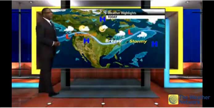
This video presents “Wind storm leaves thousands without power, prompts travel advisories in Ontario and Quebec.”
Warnings for Québec, Canada
8:04 AM EDT Friday 01 November 2013
Wind Warning for Québec Continued
In the Richelieu Valley, southerly winds will reach 90 km/h locally near the monteregian hills this morning. By midday, southwesterly winds will reach up to 90 km/h throughout the area.
A low pressure system located over Georgian Bay is tracking northeastward while intensifying and will reach Labrador this evening. Rain that is already affecting several regions of the province will last much of the day. Areas near the system’s track and some higher terrain north of the St Lawrence River will especially see significant rainfall amounts. Water levels could rise locally.
Additionally, as the cold front passes this afternoon, southwesterly winds will become high over the entire St Lawrence Valley. Items that are not secured could be tossed around by the wind.
Meanwhile, strong to high southwesterly winds will generate significant waves that will affect the north shore and the Lower North Shore. Consequently, there is a risk of breaking sea conditions near high tide.
8:04 AM EDT Friday 01 November 2013
Rainfall Warning for Québec Continued
Total rainfall amounts of 50 to 60 millimetres will affect these regions by this evening.
A low pressure system located over Georgian Bay is tracking northeastward while intensifying and will reach Labrador this evening. Rain that is already affecting several regions of the province will last much of the day. Areas near the system’s track and some higher terrain north of the St Lawrence River will especially see significant rainfall amounts. Water levels could rise locally.
Additionally, as the cold front passes this afternoon, southwesterly winds will become high over the entire St Lawrence Valley. Items that are not secured could be tossed around by the wind.
Meanwhile, strong to high southwesterly winds will generate significant waves that will affect the north shore and the Lower North Shore. Consequently, there is a risk of breaking sea conditions near high tide.
————————————–
You may also want to know:
- Photography Copyright Kit (FREE)
- Sponsored Video: World-Changing Dreamers (IF WE Challenge) – Teaser (This is a social conversation contest. Enter the contest for a chance to win prize values up to $12,000, including a trip to Paris! The Contest is open from September 16 to October 28, 2013 inclusive. Please check the important contest rules.)
- KEVIN O’LEARY: 40 YEARS OF PHOTOGRAPHY Exhibit: To Benefit Teenage Entrepreneurs (Exhibit and sale of limited edition, signed, framed prints continues to November 15, 2013. O’Leary will donate all profits from the sale of his photographs to aspiring teenage entrepreneurs in an online “Future Dragon” contest launching later this year.)
- Energy Apps for Ontario Challenge: Win $50000 for Best Apps Using Electricity Data from Smart Meters (Oct. 1, 2013 to Jan. 7, 2014)
- “Still Waters Forget / Les eaux calmes oublient”: Photography Exhibition (October 9 – December 20, 2013)
- Life on the Grid Exhibit: 100 Years of Toronto Street Photography (Exhibit continues to May 2014 from Monday to Friday; Exhibit on Saturdays: from October 19, 2013 – April 12, 2014)
- Your Input: Use of Jets at Billy Bishop Toronto City Airport + Communities’ Cultural Infrastructure (14 Ward-Based Meetings from September 16 to October 30, 2013)
- Your Input: Toronto Neighbourhoods Oct.3-Nov.1 + Open Houses on Eglinton Ave.’s Future Oct.7-9, 2013
- You’re Invited: Great Canadian Events in Ontario Sept.7-Oct.31; Toronto Road Closures Sept 7-8, 2013
- You’re Invited: Toronto’s Great Events May 18 – 21 and Victoria Day May 20, 2013 (Heritage Toronto Tours April – October 2013)